Interactive map, West Cork
Roaringwater Places
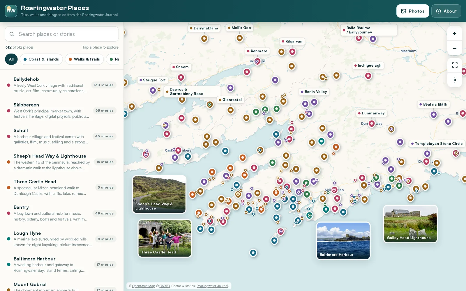
The Roaringwater Journal has spent fifteen years writing about West Cork — 1,205 posts on its castles, megaliths, islands, walks and festivals. This turns that archive back into geography: 312 destinations you can pan around, each carrying the stories and photographs written about it.
- destinations mapped
- 312
- journal stories linked
- 804
- photographs indexed
- 3,146
- mapping libraries used
- 0
Try it here
Drag to explore, click a pin for its stories, or open it full screen.
Turning an index back into a place
The journal's indexes are organised the way an archive is: by section, then by date. They are wonderful lists and hopeless maps. If you are standing in Skibbereen wondering what is worth the drive, a chronological column of post titles is not much help.
So all 1,205 posts were read for the places they are about. The authors tag their own posts — Dunmanus Castle, Mount Gabriel, Barley Cove — and those tags were matched against a gazetteer built from three sources: every named feature OpenStreetMap holds for the region, Wikidata's curated heritage records, and 2,800 monuments OpenStreetMap records without a name at all. A tag none of them can place is dropped rather than pinned somewhere plausible.
Where the pin comes from decides how precise it is. OpenStreetMap's surveyed nodes win, because Wikidata still rounds many settlements to the arcminute. Wikidata fills the gaps OpenStreetMap leaves — Dunmanus Castle is not in OSM at all. And where a post is tagged with a townland and a monument, the unnamed monument OSM records inside that townland becomes the pin. Where none of that lands on an actual spot, the pin sits at the centre of the townland and says so on its card rather than implying a precision it does not have. 85 of the 312 carry that caveat.
Posts about the same place merge onto one marker, so Ballydehob carries 130 stories behind a single pin rather than 130 pins arguing over the same village. Every description was then written from the place's own posts — what the journal actually says about it — rather than left as a bearing and a distance.
No mapping library
The whole thing is one HTML file with its CSS inline and about 1,500 lines of JavaScript beside it. No Leaflet, no MapLibre, no build step, no npm. The Web Mercator projection, tile grid, pinch handling and zoom anchoring are all written out longhand, which is why the map arrives in two requests.
Tiles are grouped into one container per zoom level. When you zoom, the level you came from stays underneath, stretched to line up, until the new tiles have landed, so the map never flashes white. Tiles load from the middle of the screen outwards, and a ring of off-screen tiles is kept so that short pans never refetch anything.
Pinching applies a live CSS transform to the basemap and commits to the nearest whole zoom when your fingers lift, so it tracks continuously instead of stepping. The pins are walked through the same transform by hand each frame rather than being scaled with it, so they stay their proper size throughout the gesture.
Because this is a map you would use standing in a field wondering what is over the next hill, the location button watches your position rather than sampling it once. The GPS accuracy is drawn as a real radius on the ground, so it shrinks as you zoom in rather than staying a decorative blob, and every place picks up a live distance the moment a fix arrives. The list reorders to nearest-first and the Google Maps button becomes directions. The position never leaves the browser.
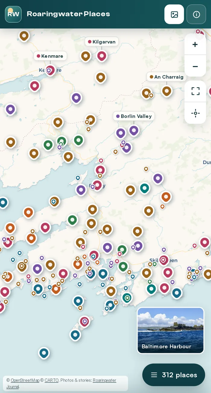
On a phone the place list is a bottom sheet, and crowded pins become dots until you zoom in.
Making seventy pins legible
Three hundred and twelve markers, most of them inside Roaringwater Bay, is a puddle of teardrops. Three passes run whenever the map settles, and none of them run while you are dragging:
Thinning. Working down from the most-written-about place, any pin that would land on top of one already drawn is demoted to a small dot. The density stays visible and the coastline does not disappear, and zooming in promotes them back.
Labels. Each name is tried in eight positions around its pin and takes the first that clears every marker and every label already placed. A name that cannot be placed cleanly is dropped rather than smeared across its neighbours. Where a label ends up far from its pin, a hairline leader connects them.
Photographs. The same slot search runs for the photo cards, which additionally avoid the map controls, the attribution and each other, and are budgeted by zoom level and screen area so they never swamp the map.
Between settles, panning is nothing but a transform per element — the collision work is already done, and the label offsets travel with their pins.
Photographs are pulled straight from the posts, cropped by the journal's own CDN to exactly the size each slot needs.
The photographs load instantly
The obvious way to show a post's photography is to ask the WordPress API for it when someone opens a place. That is a round trip per story, and a gallery that arrives late and rearranges itself under your thumb.
Instead, all 804 posts were walked once, ahead of time, and 3,146 photographs were baked into the page as a 125KB index. Opening a place shows its gallery immediately, with no API call at all. Each image is requested at exactly the size its slot needs, and the neighbours in a gallery are warmed in the background so arrow keys and swipes never wait.
An earlier version leaned on website-screenshot previews. They were slow, frequently blank, and showed a web page where a photograph belonged.
Why the tiles come from CARTO
The first version drew tiles straight from tile.openstreetmap.org. That is the one thing the OpenStreetMap Foundation's tile policy explicitly asks you not to do, and their servers enforce it: requests from an embedded map come back carrying x-blocked: Access denied and a blank image. A map that renders perfectly on your laptop and shows nothing but pins on a live site.
The basemap now comes from CARTO's Voyager tiles — the same OpenStreetMap data, served from a CDN that is built for this, cached for six months, and available at double resolution for retina screens. Both are credited in the corner, as their licences require.
Seven kinds of day out
Every place falls into one, and any combination can be filtered on.
- Coast & islands 38 places
- Walks & trails 13 places
- Nature & gardens 16 places
- Heritage & archaeology 65 places
- Towns, arts & events 58 places
- On the water & active 3 places
- Scenic roads & viewpoints 119 places